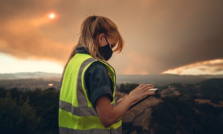
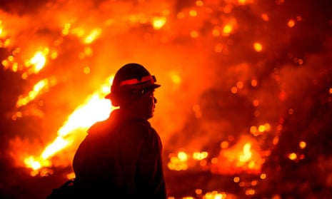
When wildfires burned near Palo Alto last month, emergency workers in this city legendary for its resident high-tech companies relied on relatively low-tech tools to coordinate a response.
Emergency response units talked by two-way radio and sent each other text messages with photos of paper maps, said Kenneth Dueker, the director of Palo Alto’s office of emergency services.
“Here we are right in the middle of Silicon Valley,” Dueker said. “Why am I using paper and pencil and a two-way radio when I should be using geospatial tools? It’s very 1920s, frankly.”
California fires are evolving amid global warming, becoming more frequent, more intense, faster-moving and more difficult to contain. The communications of those who fight them, however, are stuck in the past, Dueker said.
To address this, Palo Alto’s office of emergency services is working with the startup Perimeter to beta test a product that would act as a kind of Google Maps or Waze for emergency responders.
The tool is meant to provide real-time information to first responders during emergencies, allowing them to collaboratively report conditions and download maps to reference offline, as many rural areas where they work have little cell service.
It should also improve communication between the various entities responding to fires, including teams from different areas. Natural disasters do not respect city or county lines – one fire in the recent spate of wildfires in California straddled the borders of three different counties.
Currently, communication is coordinated through Computer Aided Dispatch computer systems, which can differ by county and department, and radios, which allow only one person to speak at a time.
“The two-way radio is great for short, quick efficient communication, but then it starts to break down if you need to start giving detailed information or a long list of things,” Dueker said. “A picture’s worth a thousand words and I definitely don’t want someone saying a thousand words on radio.”
This article includes content provided by Instagram. We ask for your permission before anything is loaded, as they may be using cookies and other technologies. To view this content, click 'Allow and continue'.
Bailey Farren, Perimeter’s co-founder and CEO, grew up near the Bay Area where her father was a firefighter and her mother was a paramedic. Lagging communication technology has been a concern for first responders for years, she said, but this year it feels more acute than ever.
“There have always been fires but having the scale of these massive fires is new, and it has become extremely apparent the old way of doing things is not going to work for the new normal,” she said.
Farren founded Perimeter with now-CTO Noah Wu when they were students at University of California, Berkeley. Ultimately Farren said she hopes to expand the app to also serve civilians in fire-prone zones and provide maps of areas affected by evacuation orders and other information. Evacuation alerts are currently sent primarily in text format, leaving civilians to figure out the radius of the affected area.
“Typically you get a text describing an evacuation zone but it is hard to visualize what a direction like ‘evacuate if you are east of Adobe road’ looks like, for example.” she said. “Nobody has that memorized. It is much better than nothing but they are not as effective as they could be.”
Glitches in software and outdated maps have been reported in the warning systems used to alert people in the path of the flames during several major fires in the last year. Perimeter hopes to partner with notification organizations to send a URL that attaches to a more-frequently updated map, she said.
In addition to helping people on the ground during fires, technology like Perimeter can be used collect information to help experts understand what happened during the fire, how weather affected it and how it moved, Farren argued.
“It is essential to collect data about what happens during the fire because it enables us to respond more effectively in the future,” she said.
Timothy Ingalsbee, the executive director of Firefighters United for Safety, Ethics and Ecology, said Computer Aided Dispatch has worked well in the past, but that it is becoming increasingly difficult to share the location of current fires because they now move so quickly.
“What you see on the web is not keeping pace with the actions on the ground, because in an hour these fires are spreading through a thousand acres,” he said. “You are not sure where the fire is at or what fire you are seeing – especially when they start merging. It is extremely challenging right now.”

The scale of the fires and the rate at which they burn make them more dangerous than ever, said Ingalsbee, who has been working with wildfires since the 1980s.
“The scale of activity and the incredible speed at which these fires are spreading is beyond what anyone alive today has ever experienced,” he said. “It is clear that this is climate change. The future is now.”
There are many ways fire technology has been enhanced in recent years: aerial technology including drones and planes with infrared cameras can more easily track the real-time location of a fire. Satellite imagery can show fires across large stretches of land. It is now easier to track crew members and make sure nobody is lost or left behind. Modeling and mapping technology is getting more accurate in predicting where and how fires will spread.
For all the new technology being developed, Ingalsbee stressed, a major tool in managing the wildfires already exists, and has for quite some time: controlled burns. Scientists say that in addition to climate change, fire suppression has played a significant role in the increasing size and destruction of some wildfires.
The practice was common among indigenous peoples of California for thousands of years before it was outlawed in the late 19th century, helping to clean out fire fueling vegetation, renew the ecosystem and form barriers to larger, runaway fires later. It is only by returning to this ancient practice that fires could effectively be managed – not eliminated, he said.
“We don’t lack the technology, we lack the wisdom to use it appropriately,” Ingalsbee said. “Maybe we should not fight all fires, as we are doing in futility, but work with them. Old wisdom fused with new technology could really do a lot of good.”
